Anúncios
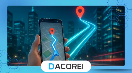
As dicas do Google Maps tornaram-se essenciais para navegar com confiança em locais desconhecidos e evitar estresse desnecessário ao viajar em cidades ou áreas rurais.
Este artigo explica maneiras práticas de usar o Google Maps de forma eficaz, mesmo quando problemas de conexão ou sinal dificultam a navegação digital durante viagens importantes.
Ao compreenderem funcionalidades como mapas offline, personalização de rotas e compartilhamento de localização, os usuários obtêm ferramentas poderosas que evitam confusões ou caminhos errados em ambientes desconhecidos.
Os viajantes modernos dependem muito da navegação móvel, portanto, dominar recursos avançados garante deslocamentos mais seguros e informados em espaços urbanos movimentados ou locais remotos.
Este guia mostrará como planejar com antecedência, usar ferramentas ocultas e se adaptar rapidamente quando os mapas mudarem ou os sinais falharem durante situações reais de viagem que exigem decisões rápidas.
Anúncios
Seguir esses passos aumenta a consciência, melhora a precisão e ajuda as pessoas a se manterem orientadas, chegarem aos destinos com eficiência e nunca mais se perderem em seus deslocamentos diários.
Planeje sua rota antes de sair.
Planejar uma rota com antecedência ajuda os usuários a antecipar congestionamentos, fechamento de vias e caminhos alternativos, o que pode economizar tempo ou evitar situações estressantes em locais desconhecidos.
O Google Maps permite criar vários pontos de parada, o que é especialmente útil para entregas ou passeios turísticos que exigem gerenciamento preciso de pedidos e planejamento de navegação eficiente do início ao fim.
Conhecer o trajeto à frente aumenta a confiança e permite monitorar os arredores com mais atenção enquanto se seguem as instruções passo a passo exibidas na tela ou por meio de orientação por voz.
Muitos viajantes consultam avaliações e fotos de destinos desconhecidos, garantindo que cheguem à entrada ou estacionamento corretos, em vez de perder tempo procurando nas proximidades.
Verificar duas vezes o trajeto escolhido reduz a ansiedade e garante uma chegada segura em momentos críticos, como reuniões de negócios, consultas médicas ou partidas para o aeroporto.
Aplicativos essenciais para facilitar o dia a dia
Use mapas offline antes que o sinal caia.
O download de mapas offline evita falhas de navegação em áreas sem cobertura de dados móveis ou onde os custos de roaming tornam a navegação em tempo real muito cara.
Os usuários podem aprender como baixar regiões facilmente no guia oficial. Suporte do Google, garantindo acesso total às rotas mesmo sem disponibilidade de internet.
Os mapas offline ajudam os motoristas a se manterem no caminho certo em montanhas, túneis e rodovias rurais onde os sinais desaparecem repentinamente, o que é um problema comum durante viagens rodoviárias.
Pessoas que trabalham em áreas remotas, como motoristas de entrega ou excursionistas, evitam situações perigosas causadas pela perda inesperada do GPS ao usar dados offline de forma eficaz.
Salvar mapas offline antes de viajar garante uma navegação mais segura e evita erros críticos, especialmente quando a bateria e a conectividade precisam ser preservadas de forma inteligente durante longas viagens.
++Passo a passo: Como atualizar o Android ou iPhone
Personalize a navegação do seu perfil.
O Google Maps permite escolher entre dirigir, andar de bicicleta, usar o transporte público ou caminhar para gerar rotas que correspondam às necessidades reais e evitem caminhos inconvenientes durante deslocamentos diários ou viagens longas.
Ciclistas podem contar com dados de rotas adequadas para bicicletas fornecidos por organizações como Serviço Nacional de Parques, ajudando-os a evitar rodovias inseguras ou superfícies íngremes não pavimentadas.
As configurações de acessibilidade permitem solicitar rotas acessíveis para cadeiras de rodas com rampas e elevadores, auxiliando usuários com necessidades de mobilidade em espaços públicos desconhecidos ou terminais de transporte que exigem planejamento adicional.
Os motoristas podem evitar pedágios, balsas ou rodovias ajustando as opções de navegação, o que oferece maior controle sobre os custos da viagem e ajuda a personalizar o trajeto de acordo com as preferências pessoais.
Personalizar a visualização do mapa, a sobreposição de tráfego e os alertas de voz melhora a clareza e reduz os erros de condução, especialmente ao viajar por grandes cidades com cruzamentos complexos e tráfego intenso.
| Configuração personalizada | Beneficiar | Ideal para |
|---|---|---|
| Evite os pedágios | Economiza dinheiro | passageiros diários |
| Rotas de bicicleta | Ciclismo mais seguro | Ciclistas urbanos |
| Caminhos acessíveis | Mobilidade sem degraus | Usuários de cadeira de rodas |
| Vista de satélite | Referência visual | Turistas explorando pontos turísticos |
Compartilhe a localização para segurança e coordenação.
O compartilhamento de localização permite visibilidade em tempo real, ajudando amigos ou familiares a saberem exatamente onde alguém está durante viagens que exigem coordenação rápida.
Equipes de resposta a emergências e especialistas internacionais em segurança em Ready.gov Recomenda-se compartilhar a localização em tempo real ao viajar sozinho ou ao encontrar estranhos para compras online.
As famílias usam o compartilhamento de localização para monitorar adolescentes que chegam tarde em casa, reduzindo o medo e melhorando a comunicação sem o envio constante de mensagens de texto pedindo atualizações.
Compartilhar a previsão de chegada reduz o tempo de espera, ajudando as pessoas a se cumprimentarem de forma eficiente em aeroportos, estádios ou casas de shows, onde as multidões muitas vezes dificultam as ligações telefônicas.
Os usuários podem interromper o compartilhamento a qualquer momento, mantendo a privacidade e utilizando esse recurso poderoso apenas quando necessário para garantir uma chegada segura e evitar mal-entendidos perigosos.
Utilize pontos de referência e pistas visuais
Mesmo com mapas digitais, prestar atenção ao ambiente ajuda os usuários a identificar as estradas corretas, especialmente quando os semáforos causam pequenos atrasos ou as instruções de voz chegam com atraso.
Os viajantes podem visualizar no Street View onde entrar em edifícios, estacionar carros ou encontrar grupos, evitando confusão perto de estruturas semelhantes que, às vezes, parecem idênticas à distância.
Pontos de referência como igrejas, monumentos ou terminais de ônibus ajudam a confirmar a direção, pois esses pontos visuais permanecem constantes mesmo que a seta do GPS se mova temporariamente de forma incorreta.
Em áreas centrais movimentadas, os pedestres se beneficiam da calibração da bússola, garantindo que a orientação do mapa corresponda ao movimento real para frente, em vez de girar de forma imprevisível.
Observar os nomes das ruas, as fachadas das lojas e as placas de trânsito reforça a percepção e reduz o risco de errar o caminho ou caminhar na direção errada quando as orientações são atualizadas lentamente.
Armazenamento do celular cheio? Como liberar espaço com segurança
Mantenha a bateria e o GPS confiáveis.
A navegação consome bateria rapidamente, portanto, ativar o modo de economia de bateria ou levar um carregador portátil garante o funcionamento completo durante viagens longas que dependem muito do uso constante do GPS.
Recomendações técnicas de Desenvolvedores Android Explique como o GPS funciona e por que uma localização precisa requer suporte de hardware estável e uma conexão forte com os satélites.
Desativar aplicativos desnecessários reduz o superaquecimento e aumenta o desempenho do telefone, evitando reinicializações repentinas que deixam os usuários sem qualquer orientação em momentos críticos.
Atualizar o Google Maps regularmente garante novos dados de rotas, correção de erros e opções de navegação aprimoradas que respondem melhor a mudanças inesperadas nas estradas ou atualizações na infraestrutura da cidade.
A verificação de permissões garante que o aplicativo acesse sensores necessários, como GPS e detecção de movimento, melhorando a precisão e evitando saltos de localização incorretos que podem enganar os usuários.
Conclusão
As pessoas se sentem mais seguras quando entendem os principais recursos do Google Maps, porque uma navegação melhor permite viagens mais tranquilas e reduz o estresse em ambientes desconhecidos.
Preparação, personalização e conhecimento, em conjunto, transformam smartphones em assistentes de viagem confiáveis que funcionam mesmo sem conexão constante à internet ou sinal forte.
Aprender a usar essas ferramentas capacita todos, desde viajantes individuais até pessoas que se deslocam diariamente para o trabalho, a se locomoverem de forma mais inteligente e a evitarem erros dispendiosos ou perigosos durante o deslocamento.
Com o conhecimento certo, os usuários se mantêm orientados, comunicam-se melhor e chegam com confiança, transformando cada jornada em uma experiência mais previsível e confortável.
Perguntas frequentes
1. Como o Google Maps pode me ajudar se eu perder o sinal?
Os mapas offline permitem a navegação completa sem acesso à internet.
2. Por que devo compartilhar minha localização com outras pessoas?
Aumenta a segurança e facilita as reuniões.
3. Como evitar pedágios ao dirigir?
Ajustar opções de rota para bloquear rodovias com pedágio.
4. O Google Maps pode ajudar usuários com deficiência?
Oferece opções de navegação acessíveis para cadeirantes.
5. Por que meu GPS às vezes mostra a direção errada?
Problemas de orientação exigem calibração da bússola.